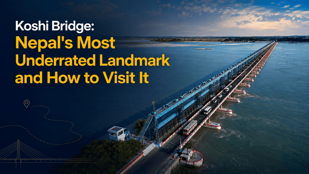
Koshi Bridge: Nepal's Most Underrated Landmark and How to Visit It
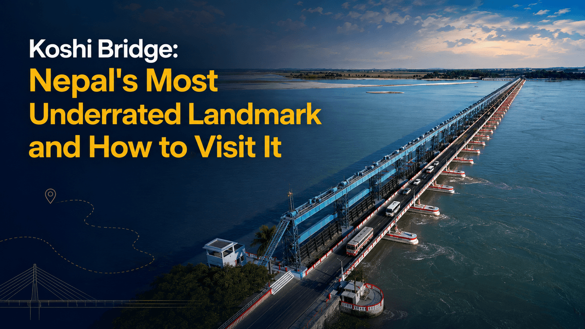
Every night, dozens of buses between Kathmandu and eastern Nepal cross a 1,150-metre structure over the Saptakoshi River, and almost every passenger sleeps through it.
That is a shame, because the Koshi Barrage — the thing most people mean when they say "Koshi Bridge" — is one of the most remarkable pieces of infrastructure in South Asia. It is the only road link between two provinces. It has 56 gates holding back the most dangerous river in Nepal. It was inaugurated by a king and a prime minister standing together. It has broken catastrophically once, drowning a region. And it is now more than a decade past the end of its design life, shaking under the weight of the traffic still crossing it.
It is also genuinely worth visiting. Here is what it is, why it matters, and how to actually see it.
First, which Koshi Bridge?
There are two, and they get confused constantly.
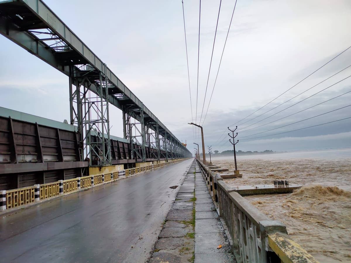
The Koshi Barrage — sometimes called the Koshi Bridge — is the big one. 1,150 metres long, 10 metres wide, 56 gates, carrying the Mahendra Highway across the Saptakoshi between Bhardaha in Saptari and Bhantabari in Sunsari. Built between 1958 and 1962. This is the landmark, and this is what the rest of this guide is about.
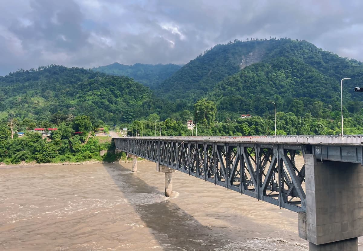
The Koshi Bridge at Chatara is a separate, much newer structure further upstream — 261 metres long, built with Asian Development Bank support after the 2008 flood as an alternative crossing, and opened in the middle of the last decade. It matters enormously to people in Sunsari, Saptari and Udayapur, and it is the backup if the barrage ever fails again. But it is not the landmark.
If someone tells you to go and see the Koshi Bridge, they mean the barrage.
Koshi Barrage at a glance
Length | 1,150 m |
Width | 10 m |
Gates | 56 |
Built | 1958–1962 |
Opened | 1962 |
Designed and built by | Joseph and Company Limited, India |
Connects | Bhardaha (Saptari, Madhesh Province) ↔ Bhantabari (Sunsari, Koshi Province) |
Carries | Motor vehicles, bicycles, pedestrians |
Distance from Itahari | About 42 km west |
Nearest reserve | Koshi Tappu Wildlife Reserve, a short distance north |
Best months to visit | November to March |
The story behind it
The Koshi is not a normal river. It drains a vast Himalayan catchment, carries an enormous sediment load, and has historically responded to that sediment by simply changing course — sometimes moving tens of kilometres sideways across the plains. In Bihar it earned the name "the sorrow of Bihar" for the floods this produced.
The barrage was the answer to that. Under the Koshi Agreement signed between Nepal and India on 25 April 1954, a structure would be built to control the river, provide irrigation, and reduce flooding in both countries.
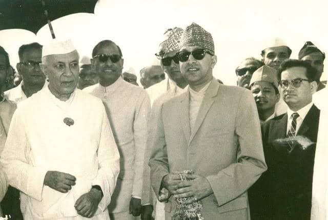
Construction began in 1958. On 30 April 1959, King Mahendra of Nepal and India's first Prime Minister Jawaharlal Nehru laid the foundation together at Bhimnagar, in front of a crowd of thousands. Accounts of the project describe over a million people involved in the work at various stages — trams ran from Dharan to Bhimnagar and ropeways carried boulders down from the hills. Dharan's Railway Chowk is named after that tram line, which is a small piece of history most people in Dharan no longer know.
It opened in 1962.
What went wrong in 2008
On 18 August 2008, the Saptakoshi burst through its eastern embankment about 8 km north of the Indian border.
The numbers are hard to hold in your head. Peak flow reached roughly 166,000 cubic feet per second against a typical 25,744. The river carved an entirely new course, 15 to 20 km wide and around 150 km long. Over two hundred people died across Nepal and India. Tens of thousands of Nepalis were displaced, and in Bihar the figure ran into millions. Road connectivity between eastern Nepal and the rest of the country was cut for months.
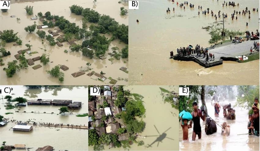
It remains one of the costliest and deadliest disasters in Nepal's recorded history, and it is the reason the Chatara bridge exists.
Understanding this is part of understanding the barrage. It is not a monument. It is a working, straining piece of flood-control infrastructure holding back a river that has repeatedly demonstrated what it can do.
The uncomfortable present
The barrage was designed for a working life of around fifty years. It has now been operating for over sixty.
Reporting on the structure describes it as dilapidated, with the deck shaking noticeably when heavy vehicles cross, and both local communities and elected representatives have raised safety concerns for years. It remains the only physical road link between Koshi Province and Madhesh Province at this point on the highway, which is precisely why the problem is so difficult — you cannot simply close it.
A replacement is planned. Proposals have circulated for a new multi-kilometre bridge across the Saptakoshi, along with a bypass road to take highway traffic off the barrage entirely. Detailed project work has been under preparation. But as of writing, the crossing you use is still the 1962 structure.
During high monsoon flows, the barrage authorities open gates and restrict heavy vehicle movement — in October 2025, all 56 gates were opened when flows exceeded 500,000 cusecs, and heavy vehicles were banned from the crossing. If you are travelling in monsoon, this is a real possibility rather than a theoretical one, and it can reroute or delay eastern buses.
How to visit
Getting there
From Itahari — about 42 km west on the Mahendra Highway. Local buses, micros and jeeps run frequently. This is the easiest base, and Itahari is well connected to Kathmandu. Our Kathmandu to Itahari route guide covers that leg.
From Biratnagar or Dharan — via Itahari, adding 25 km or 16 km respectively.
From Kathmandu directly — any eastbound bus toward Itahari, Biratnagar, Damak or Kakarbhitta crosses the barrage. You can simply ask to be set down at Bhardaha or Bhantabari.
From the Janakpur side — westbound on the Mahendra Highway through Saptari.
When to go
November to March is the window. The weather is comfortable, the river is low and clear, and the migratory birds are in. This is also when Koshi Tappu is at its best, which matters because the two should be visited together.
Avoid the monsoon. June to September is when the Koshi is genuinely dangerous, gates are opened, vehicle restrictions come in, and the surrounding area floods. It is also, admittedly, when the barrage is at its most dramatic — but this is not a spectacle to seek out. These are working floods that damage real communities.
Time of day: early morning and late afternoon. Midday on an exposed 1,150-metre concrete deck in the Terai is punishing.
What it is actually like
You can walk across. Pedestrians and cyclists use it alongside vehicles, and walking the full length is the way to understand the scale of the thing — the gates receding into the distance, the enormous braided river below, the sediment banks, and the sheer width of the floodplain on either side.
Come at sunrise if you can. Mist on the water, birds moving over the channels, and the low light on all fifty-six gates is the photograph.
A word of caution: this is a working piece of border-adjacent flood-control infrastructure with security presence. Be sensible about where you point a camera, be respectful of any instructions from staff or security personnel, and stay well clear of the roadway when heavy vehicles are crossing. The deck is narrow and there is no meaningful separation between pedestrians and trucks.
Pair it with Koshi Tappu
This is the part most visitors miss, and it is the strongest argument for making the trip.
Koshi Tappu Wildlife Reserve sits just north of the barrage — the reserve office at Kusaha is a short distance off the Mahendra Highway. It is Nepal's most important wetland, a Ramsar site, and by some distance the best birding destination in the country. Hundreds of species have been recorded here, including migratory waterfowl that arrive in winter in enormous numbers.
It is also the last refuge of Nepal's wild water buffalo, the arna, which survives nowhere else in the country.
The barrage and the reserve are the same landscape and the same story — the river, its sediment, its floods, and the wetlands they create. Seeing one without the other is only half the visit. Our guide to Nepal's national parks and reserves covers Koshi Tappu in more detail, including permits and the best season.
What else is nearby
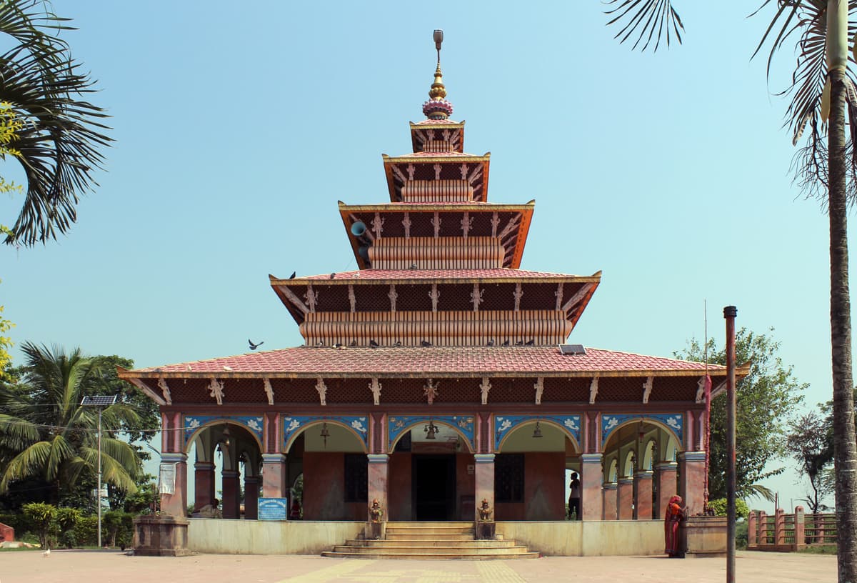
Kankalini Temple at Bhardaha is a significant Shakta site drawing pilgrims from both Nepal and India — an easy stop on the Saptari side.
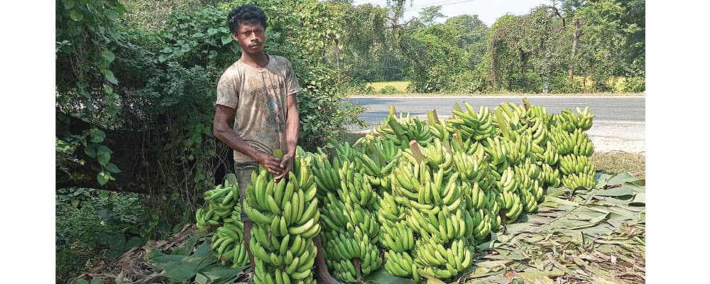
Bhardaha's banana orchards have become genuinely well known in recent years, and the roadside fruit here is worth stopping for.
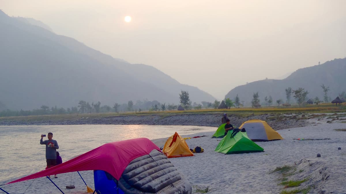
Picnicking on the riverbanks is what locals actually do here. On weekends and holidays the banks near the barrage fill up with families. It is a good reminder that this is a lived-in place rather than a monument.
Itahari, Dharan and Bhedetar are all within easy reach for a longer trip east.
Practical tips
Carry water and a hat. There is no shade on the crossing.
Do not plan around the barrage in monsoon. Restrictions and closures are real.
Combine it with Koshi Tappu, ideally staying a night nearby so you can be at the wetlands at dawn.
Small notes for local transport. Micros and jeeps from Itahari work in cash.
Ask before photographing anything that looks like security infrastructure.
Check bus timings for the return, particularly if you have been set down on the highway rather than at a bus park — evening services fill up.
Explore Nepal with GoMyGo
The Koshi Barrage is easy to reach and hard to plan for, mostly because it is not a destination anyone sells tickets to. You get there by taking an eastbound bus and getting off at the right place, or by basing yourself in Itahari and going out for the day.
That makes the Kathmandu leg the part worth booking properly. GoMyGo shows live inventory for eastern routes across the app, on Android and iOS, and the website — every departure toward Itahari, Biratnagar, Damak and Kakarbhitta, with coach types, real boarding and dropping points, and a live seat map.
Payment goes through eSewa, Khalti, IME Pay, fone Pay, ConnectIPS, Indian UPI and PayPal for anyone booking from across the border — relevant here, since the Koshi story belongs as much to Bihar as it does to Nepal.
Confirmation arrives by email and SMS immediately, and support is available around the clock on WhatsApp at +977-9704666777.
Final Words
Nepal's landmarks are mostly temples and mountains. The Koshi Barrage is neither, which is probably why it gets left off every list.
But it is a 1,150-metre wall of steel and concrete built by two countries to argue with a Himalayan river, opened by a king and a prime minister, broken once by the water it was meant to hold, and still carrying the traffic of an entire region sixty years past the day it was supposed to retire. There are not many structures anywhere that carry that much history in plain sight.
Get off the night bus at Bhardaha. Walk across at sunrise. Then go north to Koshi Tappu and watch the birds come off the water. It is a better day out than almost anyone tells you.
Frequently Asked Questions
Written by
GoMyGo Team
The GoMyGo team covers Nepal travel, bus routes, booking tips, and everything you need for a smoother journey.